
Monte Tamaro e Monte Gradiccioli
Information
| Date: | 17 September 2020 |
| Maximum height: | 1962 m |
| Difference in height: | 1030 m |
| Length: | 12.5 km |
| Kilometers effort: | 26.2 kmef |
| Duration: | 6 hours |
| For the following peaks, there are other variants of the ascent: | Monte Tamaro |
| Monte Gradiccioli |
Difficulties (Automatic translation in english)

|
From Alpe di Neggia to Monte Tamaro (T2+ the last 130 metres north of the summit). |
|
|
From Monte Tamaro to Monte Gradiccioli. |
|
|
From Monte Gradiccioli to Alpe di Neggia via the Monti Idacca. |
Comment (Automatic translation in english)
The initial objective of this excursion was Monte Tamaro, although later, as you will see, Monte Gradiccioli was also reached.
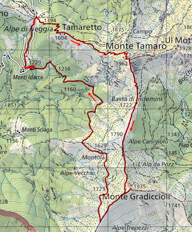
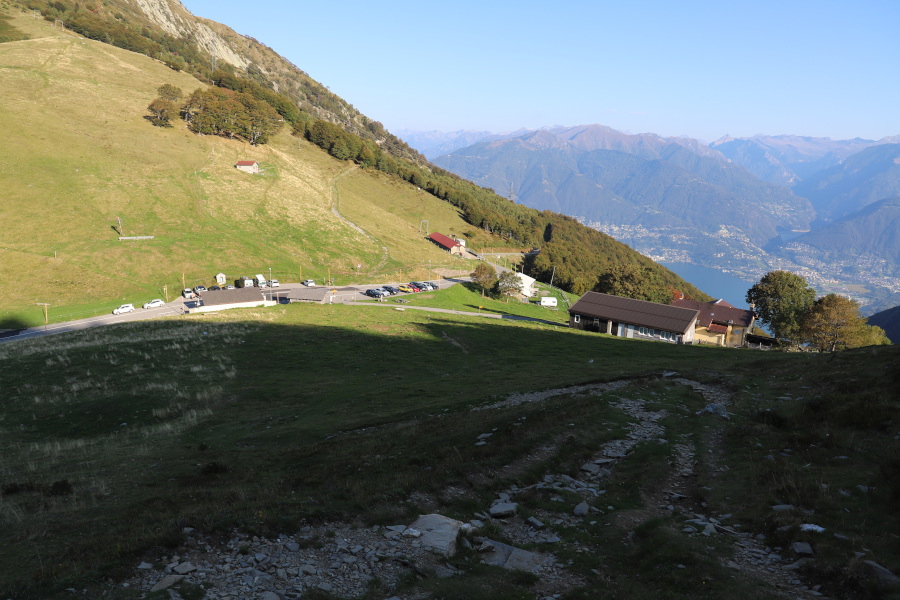
First you have to reach Alpe di Neggia, between Indemini and Gambarogno, where there is a bus stop and a large car park. You then start to climb eastwards along a well-made path with a constant gradient to the top of Tamaretto. Here there are a few old army barracks that have remained to testify to the strategic importance of this region. Continue walking towards the east and in a short time you will reach a junction where you will have to follow the right-hand path that goes straight up towards Tamaro. After about a hundred metres of difference in height, you will reach a second fork where you will have to follow the path to the right, which leads to an altitude of about 1830 metres. Here is the last fork. If you continue straight on, towards the Capanna Monte Tamaro, after about 500 metres it is possible to go back towards the Tamaro, along an easier but longer path. I preferred to take the right-hand path, which is a little more demanding (T2+) but shorter and more direct.
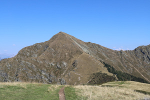
The path leads to the summit of Monte Tamaro, where there is a large cross, surrounded by benches and where there are plenty of people. The nearby cable car brings many people to the summit. Unfortunately, the situation is set to get worse in the future, as plans are afoot to build a new cable car up to Motto Rotondo, a stone's throw from the summit. Let's hope this never happens.
But back to our trip. Since the day is still long and the weather is very nice, I decide to continue towards Monte Gradiccioli, a mountain that I had never climbed before. To reach this peak, we start by descending southwards towards Bassa di Indemini, after which we continue along a very wide ridge to Bassa di Montoia. At this point, the ascent begins and, after circumventing the peak from the south, we reach the summit of Monte Gradiccioli.
This peak is often underestimated in comparison to the nearby Monte Tamaro and yet it is just as beautiful. There is a beautiful granite cross on the summit, the view is stunning and it is certainly less busy than the other.
After a break, the time has come to return and the first thing to do is to reach the Alpe di Montoia. To vary the route a little, I decided to descend from Gradiccioli towards the south and only then to go back to the alpe. Obviously it is also possible to descend directly northwards, passing through Bassa di Montoia, along the path taken uphill.
Once you reach the alpe you have to follow the path going down northwards, until you reach Monti Idacca, which unfortunately are almost 200 metres lower than Alpe di Neggia. So you have to start climbing northwards again, which, at the end of the day, is not very funny. The first stretch is on a road, but then luckily you come across a path that, crossing meadows and woods, takes you back to the starting point.
Water (Automatic translation in english)
There is a fountain with a tap at Alpe di Neggia and a water pipe west of Monte Gradiccioli, at an altitude of about 1720 metres (coordinates 2'710'021, 1'104'740). There are also several streams on the way down from Alpe di Montoia towards the Idacca Mountains.
Map of the Path

Summits


")

")


Comments (0)