
Monte Zucchero
Information
| Date: | 20 July 2023 |
| Maximum height: | 2735 m |
| Difference in height: | 1820 m |
| Length: | 18.7 km |
| Kilometers effort: | 42.9 kmef |
| Duration: | 10 hours and 30 minutes |
| Huts reached: | Capanna Osola |
| Rifugio Sambuco |
Difficulties (Automatic translation in english)

|
From Daghéi to the Osola Hut. |
|
|
From the Osola Hut to the Sambuco Hut and then up to the altitude of 2360 metres (with a few T2+ passages). |

|
From the altitude of 2360 metres to the Bocchetta di Mügaia and then up to the altitude of 2580 metres. |

|
From the altitude of 2580 metres to 2650 metres. |

|
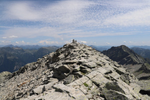
From the altitude of 2650 metres to the top of Monte Zucchero. |
Comment (Automatic translation in english)
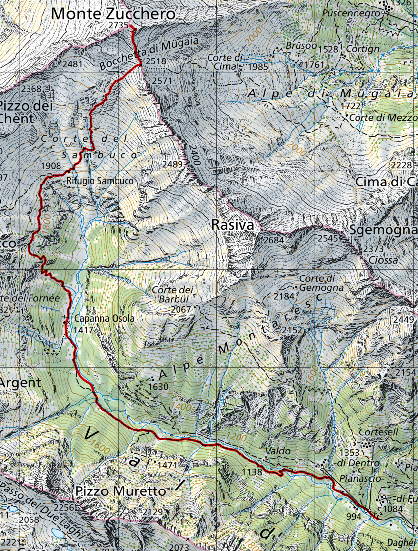
Monte Zucchero is a mountain on the border between the Maggia Valley and the Verzasca Valley. The two main routes to reach it climb from Val Redòrta and Val d'Osola. I choose to start from the latter so that I can also visit a hut and refuge that I have never reached before.
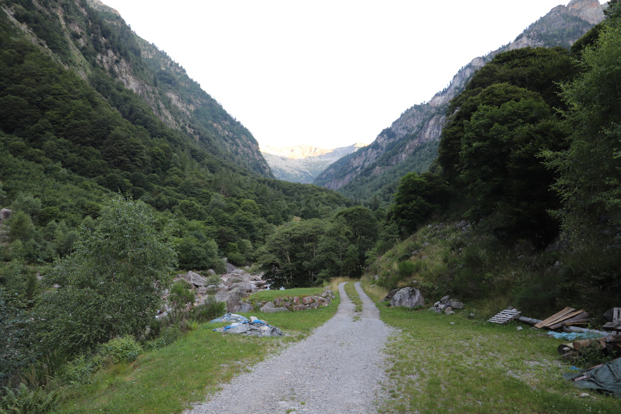
The hike begins shortly after the village of Daghéi, where a gently sloping path leads into the valley. After four and a half kilometres I reach the Capanna Osola where the path splits into two. The official one climbs first to the Corte del Fornée, then heads to the Corte di Canòva and descends to the fork at an altitude of 1798 metres. This itinerary, however, besides being longer, has the defect of requiring an extra 50 metres in height gain (and another 50 metres on the return). The old path, on the other hand, climbs directly up to the fork without any loss of altitude, but in certain sections there is a lot of tall grass and it is a little difficult to see it. I choose to follow this path until I rejoin the official path at an altitude of 1798 metres, which I then follow until I reach the Rifugio Sambuco.
A short break and then I set off again towards the Bocchetta di Mügaia along pastures that gradually give way to stones. When I reach the Bocchetta, the Val Redòrta opens up before me, with a path that also climbs on that side. Instead, I head north and without any particular problems climb up to an altitude of 2660 metres, where I encounter the most challenging section of this outing. At that point, in fact, you have to walk along the left side of a ridge formed by a long sloping rock, with several metres of empty space on the left. After this part, there is a short and easy climbing passage (I+ grade) that leads me to the south-west side of the mountain. Having passed one last scree slope, I finally reach the summit, where I find several small stone cairns waiting for me.
After eating, I prepare to descend from Monte Zucchero, but not before jumping onto the north-west summit from where I can see Lago di Tomé below. I then descend to Bocchetta di Mügaia, following the same path as on the way up, and continue on to Rifugio Sambuco. I then descend again to the Capanna Osola and walk along the valley floor back to the starting point.
Water (Automatic translation in english)
There is a fountain at Arnasset and one at Capanna Osola. There is also one at Rifugio Sambuco, but it was not working today. You can still get water inside the hut from the kitchen tap. If you run out of water, you can still get it from the river just above the hut, or from some streams a little higher up.
Map of the Path

Summits
Huts


")


")


Comments (0)