
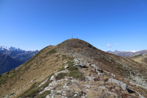
Motto Crostel
Information
| Date: | 8 October 2021 |
| Maximum height: | 2300 m |
| Difference in height: | 830 m |
| Length: | 11 km |
| Kilometers effort: | 22 kmef |
| Duration: | 5 hours |
Difficulties (Automatic translation in english)

|
From Cassin to Bassa di Nara. |

|
From Bassa di Nara to the top of Motto Crostel. |
|
|
From Motto Crostel to Passo Crastumo (with a few T2+ passages near the summit). |
|
|
From the Crastumo Pass to Cassin (T1 the road sections). |
Comment (Automatic translation in english)
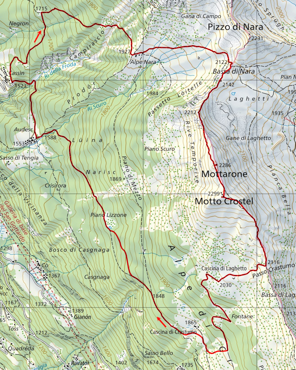
Motto Crostel is a mountain straddling the Leventina Valley and the Blenio Valley. To reach it, I started from Cassin, a small village above Chiggiogna.
I then started walking along the path that climbs to Alpe Nara, and then continued to Bassa di Nara. At that point I turned right and followed the path up the ridge to Motto Crostel.
When I reached the top, I found, in addition to a large stone cairn, a meteorological measuring station used by the Institute for the study of snow and avalanches.
For the return journey, I chose to follow the ridge that descends towards Passo Crastumo, along a path that is slightly easier than the previous one. From the pass I then descended to Cascina di Laghetto where I took the road to Cascina di Crastumo. At around 1910 metres, in order to shorten the walk, I left the road to cut directly through the meadows and thus save more than 1 kilometre. I then followed the path that heads towards Piano Lizzone which, although not official, is fairly well visible. The only thing to note is that at a certain point, just before Piano Lizzone, the path deviates quite a bit from the way it is marked on the national map. I noticed this by looking at the GPS track.
Once you reach Piano Lizzone, the route disappears into the meadow and it is a bit difficult to find it again on the other side. Once found, however, it becomes visible again and in a short time I arrive in Audesc. From there, following the road, I return to my starting point.
Water (Automatic translation in english)
There is a fountain at Cassin that was closed at the time. On the way up to Alpe Nara, there is another one at altitude 1670 metres and one at the fork at altitude 1715 metres. On the way back, I then found two more fountains along the road down from Cascina di Laghetto. One at an altitude of 1940 metres and one at an altitude of about 1910 metres.
Map of the Path

Summits


Comments (0)