
Passo San Jorio e Mottone di Giumello
Information
| Date: | 13 June 2024 |
| Maximum height: | 2027 m |
| Difference in height: | 750 m |
| Length: | 10.5 km |
| Kilometers effort: | 20.5 kmef |
| Duration: | 5 hours |
Difficulties (Automatic translation in english)

|
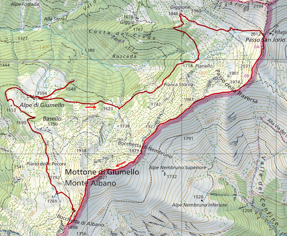
From Alpe di Giumello to Passo San Jorio and then to Passo della Traversa. |

|
From Passo della Traversa to Bocchetta di Nembruno (with some I+/II grade climbing) |

|
From Bocchetta di Nembruno up to Mottone di Giumello and then to the alp at the altitude of 1761 metres. |

|
The descent to Alpe di Giumello. |
Comment (Automatic translation in english)
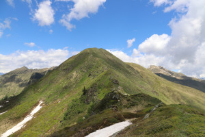
After having climbed to Marmontana and Cima di Cugn last year, this year I return to the same area to follow the ridge up to Mottone di Giumello.
I start this outing from just before the Alpe di Giumello and continue along the path that leads to Giggione and then to the San Jorio Pass. I then climb to the little church of San Jorio and continue walking along the easy slopes until I reach Passo della Traversa. Shortly before reaching the 1987 metre summit, the ridge begins to become narrower and a little rockier. The most difficult passages, however, are encountered between the summit listed at 1922 metres and the Bocchetta di Nembruno. The most challenging point is a rocky drop of about 6-8 metres where there is a metal cable to hold on to and where the difficulty I believe reaches grade II. The whole of the ridge that has just been followed can perhaps be circumvented from the Italian side, but it is necessary to go further down and lose several metres in height difference.
Having reached the pass, all that remains is to climb the easy slopes of the Mottone di Giumello to its summit. On the other side, the descent is just as easy and leads to Bocchetta d'Albano. From there, you can then descend to the alp at an altitude of 1761 metres following an old path, of which only a trace now remains. This path has also become overgrown with bushes and in some places it is a little difficult to follow the correct route.
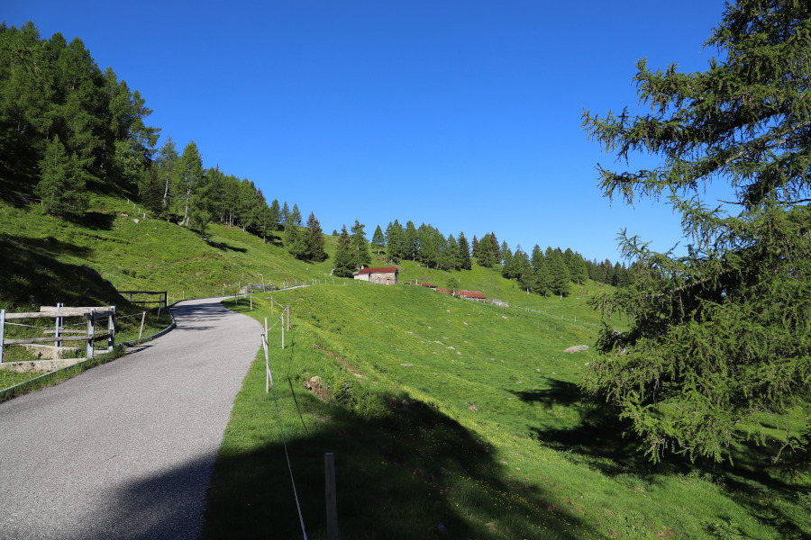
Having arrived at the alp, where there is also a small lake, I take the dirt road heading north. I soon reach Alpe di Giumello again, where this excursion ends.
Water (Automatic translation in english)
There is a fountain with a tap at Alpe di Giumello and then possibly some streams along the path up to Giggione.
Map of the Path

Summits


")

")


Comments (0)