
Piz Blas
Information
| Date: | 11 August 2021 |
| Maximum height: | 3019 m |
| Difference in height: | 1260 m |
| Length: | 15.5 km |
| Kilometers effort: | 32.3 kmef |
| Duration: | 9 hours |
Difficulties (Automatic translation in english)

|
From the Passo del Lucomagno to the end of the road, at the fork at the altitude of 1924 metres. |

|
From the fork at the altitude of 1924 metres to the Laghetti della Foppa della Rondadura. |

|
The first 800 metres of stony ground after the Laghetti della Foppa della Rondadura. |

|
From the end of the stony ground to the altitude of 2700 metres, south of Piz Blas. |
|
|
From the altitude of 2700 metres to the altitude of around 2900 metres (with some T3+/T4 passages). |
|
|
From the altitude of 2900 metres to the summit. |
Comment (Automatic translation in english)
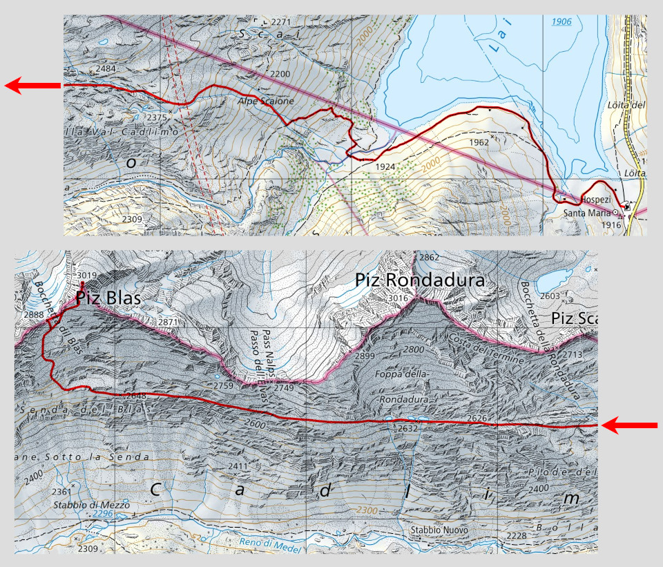
Piz Blas is a mountain located between the cantons of Ticino and Grisons. It can be reached from Ticino via the Val Cadlimo, of which it is also the highest peak.
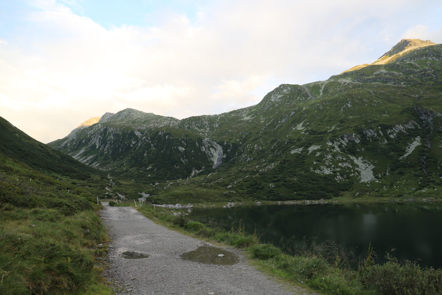
To reach it, I leave the Lukmanier Pass and follow the road that leads to Val Termine until the fork at an altitude of 1924 metres. At this point, I take the path that crosses the bridge and climbs into the Cadlimo valley. I follow it up to an altitude of 2060 m where I meet two streams coming from Alpe Scaione. Just before the second stream there is a small stone cairn that marks the beginning of the track that leads to the alpe. In the first part of the ascent, the path crosses blueberries and rhododendrons and is sufficiently visible. Further up, when you reach the meadows, the track tends to disappear a little.
When I reach Alpe Scaione, I continue to climb along the river, which I cross at an altitude of 2420 metres. At this point, I head west and climb up to the Laghetti della Foppa della Rondadura. After the lakes, there is a stretch of rocky terrain about 800 metres long, after which I reach a sort of long grassy ledge that continues fairly flat. On the ledge there is also a fairly evident track, probably created by sheep. I continue walking until I am exactly south of Piz Blas. At this point I leave the ledge and start to climb, bypassing the more difficult rocks on the left. On the way up, the grass gradually gives way to stones which at first are still small and easy to cross. Then, towards an altitude of 2900m, they become much larger but you still manage to climb them without too much difficulty.
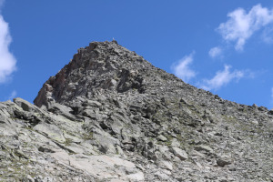
The summit of Piz Blas is wide and not very steep on the north side. There is also a beautiful cross.
For the return journey, I followed the same route as on the way up, but made a short diversions to Bocchetta dil Blas. I then descended again from the Laghetti della Foppa della Rondadura and, passing Alpe Scaione, I finally returned to the Lukmanier Pass.
Water (Automatic translation in english)
There is a small fountain near the Lukmanier hospice and then the stream that runs from Piz Scai down through Alpe Scaione. Exactly to the south of Piz Blas, at an altitude of 2645 metres, there are then two fairly large streams. You just have to be careful not to take the water where the sheep graze, which are numerous in this area.
Map of the Path

Summits


Comments (0)