
Pizzo di Cassimoi
Information
| Date: | 21 August 2010 |
| Maximum height: | 3129 m |
| Difference in height: | 1640 m |
| Length: | 15 km |
| Kilometers effort: | 36.8 kmef |
| Duration: | 11 hours |
| Huts reached: | Capanna Scaradra |
| Lakes reached: | Laghetto di Cassimoi |
Difficulties (Automatic translation in english)

|
From Larecc to the Capanna Scaradra (with T3 passages). |

|
From Capanna Scaradra to Laghetto di Cassimoi. |
|
|
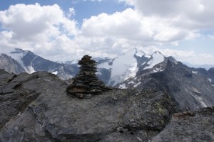
From Laghetto di Cassimoi to the south-eastern summit of Pizzo di Cassimoi and then to the pass at the altitude of 3079 metres. |

|
From the pass to the north-west summit of Pizzo di Cassimoi and back, all the way down to the pass. |
Comment (Automatic translation in english)
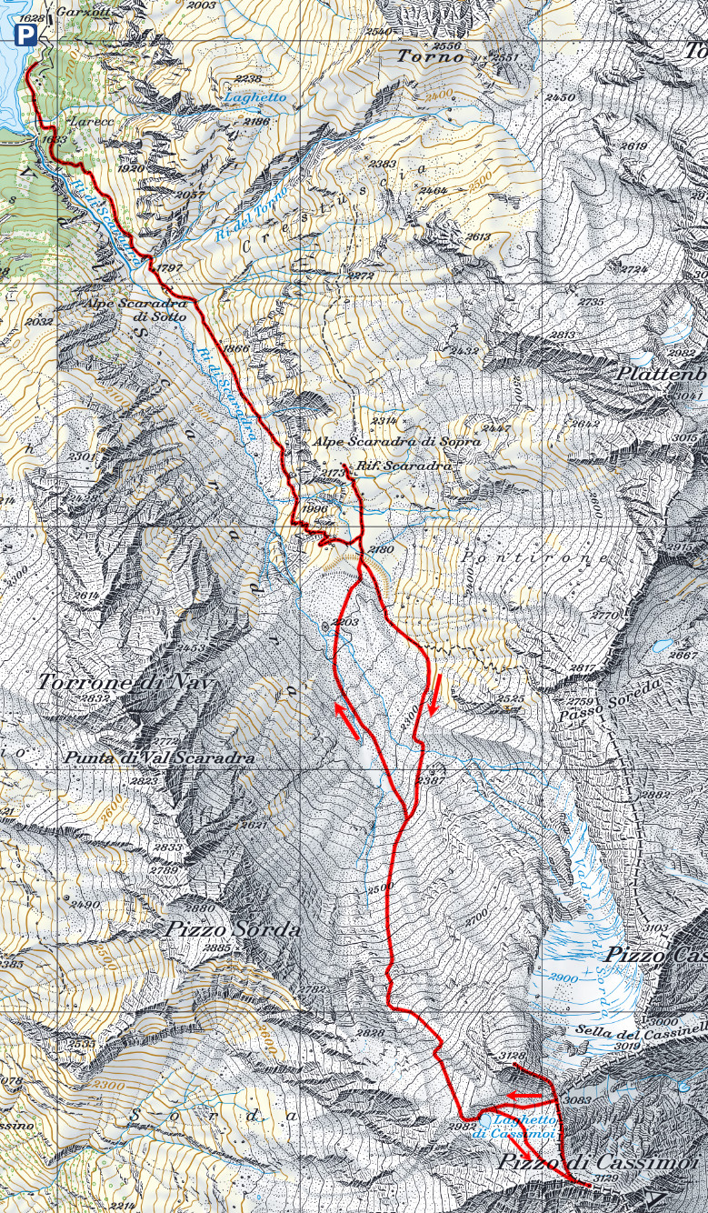
To get to Pizzo di Cassimoi it is possible to leave the car in Larecc, where there are few parking spaces, or continue to Garzott, where there are more.
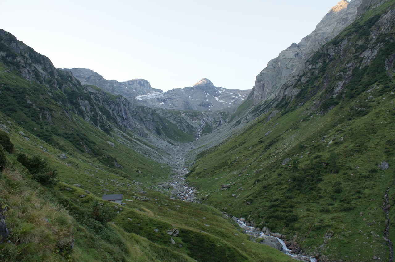
From Larecc take the path that climbs towards the Val Scaradra and begin to climb with a moderate slope. When you reach the Alpe di Scaradra di Sotto you get to a first plateau, through which you reach a steep stretch (with passages T3) that leads to the second plateau, much more marked than the first. Here it is possible, if you want to go to Capanna Scaradra, shorten the route a bit by cutting directly for the meadows. Set off from the hut, go up a stretch along the path that leads to Passo Soreda, then leave it at an altitude of 2300 meters and continue along the rocks. At an altitude of 2500 meters the first snowfields meet, which facilitate the ascent, but above all the return descent. Thus you reach the ridge that divides Val Carassino from Val Scaradra and shortly after you reach the Laghetto di Cassimoi. This lake is famous for being the highest in the Ticino and I must say that you are amazed to find so much water at this height. From the pond it is possible to go directly towards the south-east peak of Pizzo di Cassimoi, which is the highest between the two peaks. Here, in addition to the big man, we also find the summit book. Then continue towards the mouth of 3079 meters, reached which you go back on the other side following the ridge. After the last section characterized by large boulders you reach the north-west peak of Pizzo di Cassimoi. Then go down the same side up to the nozzle and here you can go directly from it to the pond (first very steep and crumbly section) or go back a short way to the south and around the most difficult part. You return to the pond and from here you follow more or less the way of going, trying to exploit as much as possible the few snowfields present. So you go back to the hut and from there back to Larecc.
This trip, although not presenting an extreme difference in level, proved to be the longest one I have ever done. This is certainly due to the approximately 1000 meters of altitude gain passed off the trail, on difficult terrain. For this reason I think it is better to climb this peak in July, when the snowfields are wider, but the summit is already clear of snow.
Water (Automatic translation in english)
There are several rivers up to the Capanna Scaradra, where there is a fountain. From the hut there are still several streams until the last one, found under a snowfield at an altitude of around 2700 metres. From there there is nothing more until the Cassimoi Pond where, in addition to the not very clear lake water, there is a small stream that flows into the pond. From here up to the summit there is nothing more.
Map of the Path

Summits
Huts
Lakes


Comments (2)
Ho provveduto a correggere l'errore.
Cordiali Saluti.