
Pizzo Cramorino
Information
| Date: | 29 August 2022 |
| Maximum height: | 3133 m |
| Difference in height: | 1670 m |
| Length: | 15.8 km |
| Kilometers effort: | 38 kmef |
| Duration: | 10 hours |
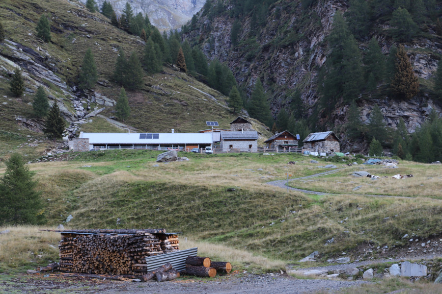
| Huts reached: | Capanna Quarnei |
Difficulties (Automatic translation in english)

|
From Cusiè to the Quarnei Hut (T1 the first part of the road). |

|
From Quarnei Hut to Alpe Cardedo and then up to an altitude of 2650 metres (with some T3 passages). |

|
From an altitude of 2650 metres to an altitude of approximately 2900 metres. |

|
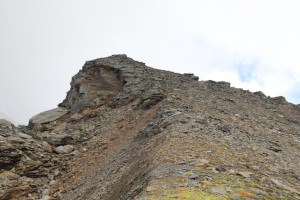
From an altitude of 2900 metres to the summit (1 passage T4 a few metres south of the summit). |
Comment (Automatic translation in english)
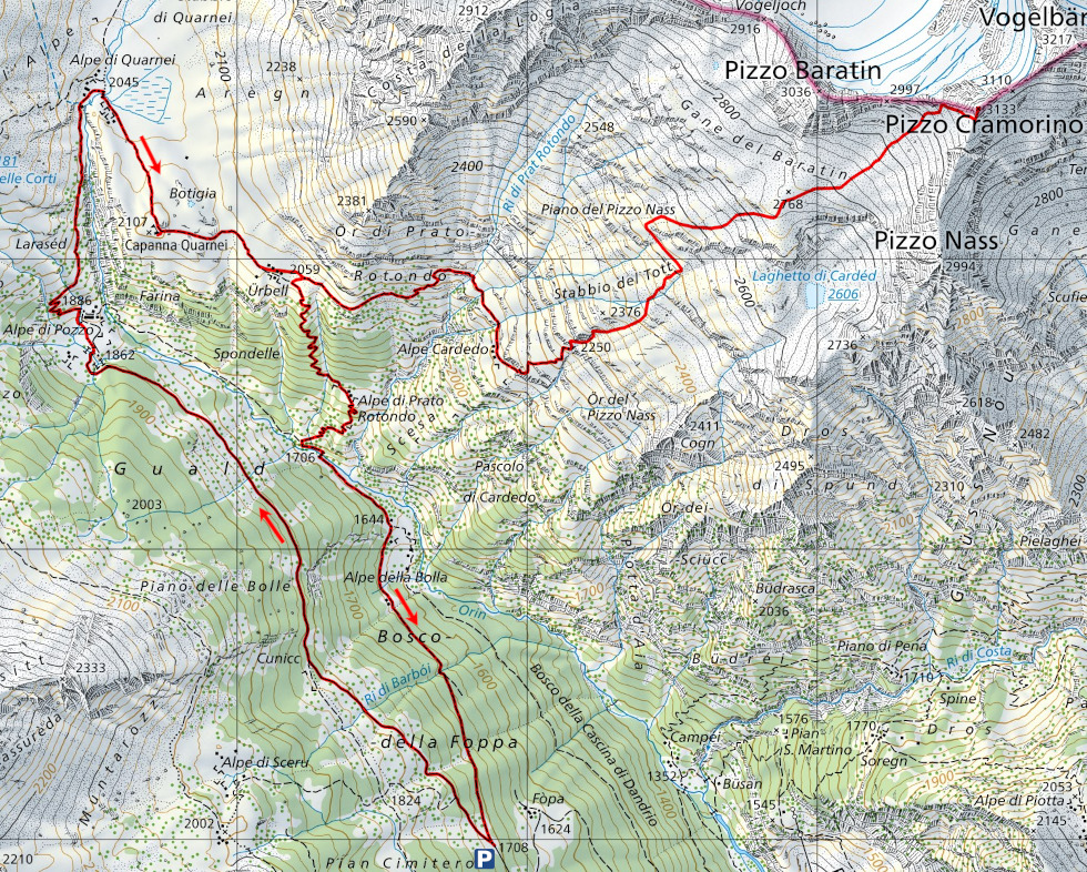
Today I plan to climb Pizzo Cramorino, a mountain located on the border between Canton Ticino and Canton Grisons. To reach it, I go up the entire Val Malvaglia to the village of Cusiè, where there is a large car park.
I then start walking along the dirt road that leads to Alpe di Pozzo and then continue along the path that goes up to Capanna Quarnei. I then head on to Ürbell, where the track starts, leading to Alpe Cardedo and then up to the 2250 metre mark. After having passed this section, I then continue up to an altitude of 2520 metres where I encounter a large rocky drop that I decide to overcome by going around it to the left. I then continue the ascent and after a while, on my right, the Laghetto di Cardedo appears, but at this time it is almost completely dry. I then continue the ascent, along a slope full of scree that makes walking tiring, until I reach the west ridge of Pizzo Cramorino. I climb it, following some blue paint marks, and finally reach the summit.
The view, however, is somewhat limited due to the fog, but I can still admire the Vogelberg in front of me and the Paradiesgletscher to my left. The temperature, however, has dropped considerably due to the clouds, so I decide not to stay too long at the summit.
After only three quarters of an hour, I already started to descend, retracing the same route as on the way up. Arriving in Ürbell, however, to vary the route a little, I descend to the Alpe di Prato Rotondo and then continue on to the Alpe della Bolla. After one last climb, I finally return to Cusiè.
Water (Automatic translation in english)
There is a fountain at Capanna Quarnei, one at Ürbell and finally one at Alpe Cardedo. Higher up, there are a few more streams up to an altitude of 2600 metres.
Map of the Path

Summits
Huts


Comments (0)