
Pizzo d'Orsino
Information
| Date: | 26 August 2025 |
| Maximum height: | 2662 m |
| Difference in height: | 700 m |
| Length: | 9.5 km |
| Kilometers effort: | 18.8 kmef |
| Duration: | 4 hours and 30 minutes |
| Lakes reached: | Lago d'Orsino |
Difficulties (Automatic translation in english)

|
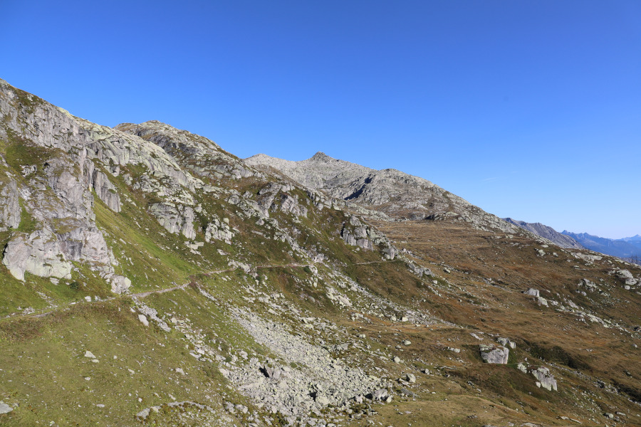
From the Lucendro dam to Lake Orsino and then up to the altitude of 2380 metres (with some T2+ passages). |

|
From the altitude of 2380 metres to the altitude of 2610 metres (T3 for the last 40 metres). |

|
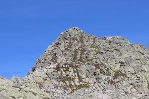
The climb to the summit at 2,629 metres and then the traverse to the base of Pizzo d'Orsino at 2,620 metres (with some grade I climbing). |

|
From the altitude of 2620 metres to the altitude of 2654 metres. |
|
|
The last 8 metres to the summit of Pizzo d'Orsino (with some grade I climbing passages). |

|
The descent from the altitude of 2620 metres to the altitude of 2510 metres. |
|
|
From the altitude of 2510 metres to the path at the altitude of 2390 metres (then T2 the descent to the fork at the altitude of 2173 metres). |
Comment (Automatic translation in english)
Pizzo d'Orsino, called Winterhorn in German-speaking Switzerland, is a mountain in the San Gottardo Pass region located on the border between the cantons of Ticino and Uri. To reach it, I decide to start from the Lucendro Lake dam and follow the path that leads to Lake Orsino. I then continue along the grassy slopes that climb north-west towards the secondary summit of Pizzo d'Orsino at an altitude of 2,629 metres. Most of the climb is fairly easy, and only in the last 20 metres does the terrain become rocky. When I reach the top, I find a beautiful cairn made of several cylindrical stones.
After a short break, I set off again in a north-easterly direction, following the ridge, which is still very rocky, until I reach Pizzo d'Orsino, which I begin to climb. At an altitude of 2620 metres, there are more grassy sections and a slight trail leading upwards. However, when there are only 8 metres of elevation gain left, I still have to climb over some large rocks before reaching the summit. There I find a small, beautiful and simple cross and a very damaged notebook to sign, which I don't even try to open. The view all around is truly fantastic, stretching from the San Gottardo Pass in Andermatt to the Furka Pass.
On the way back, I wanted to avoid having to retrace the entire rocky ridge to the south-west. So, after descending again to an altitude of 2620 metres, I head south, hoping that the route will not be too difficult. At an altitude of 2530 metres, however, I reach some fairly steep rocky slabs that I have to climb, which is quite tiring. This is because I have to go up and down several times to find a way to cross them. When I reached about 200 metres north-west of the 2480-metre point, I found grass again and the going became easier. I was then able to descend without any problems to Cascina di Giacobi and from there return to the Lucendro Lake dam.
In the end, I'm not so sure that the alternative route I took on the way back really made it any easier. Perhaps it would have been better to return via the same route I took on the way up, i.e. from the 2629-metre peak.
Water (Automatic translation in english)
There is a fountain with a tap just below the Lucendro dam. Later, I found a kind of spring just before reaching Cascina di Giacobi (2,685,062.5, 1,158,450.3). However, I didn't trust drinking from the river that flows out of Lake Orsino because there were cows grazing nearby and some of them were even going into the lake.
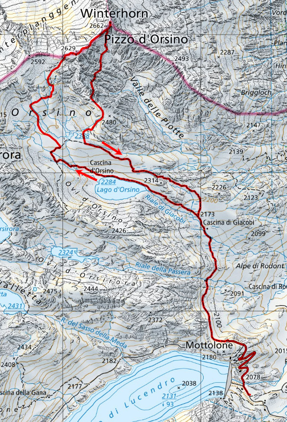
Map of the Path

Summits
Lakes


")


Comments (0)