
Pizzo Pianché
Information
| Date: | 21 June 2023 |
| Maximum height: | 2228 m |
| Difference in height: | 770 m |
| Length: | 9 km |
| Kilometers effort: | 19.2 kmef |
| Duration: | 4 hours and 40 minutes |
Difficulties (Automatic translation in english)

|
The stretch of road from Cascine Gianora to the altitude of 1786 metres, after the Alpe del Gualdo. |

|
The trail climbs to the altitude of 2100 metres. |

|
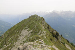
From the altitude of 2100 metres to the summit of Pizzo Pianché and then the descent to Passo dei Laghetti. |
|
|
From the Passo dei Laghetti up to the altitude of 2100 metres. |
Comment (Automatic translation in english)
In 2010, I had done the traverse from Matro to Pizzo Erra, but skipped Pizzo Pianché to avoid making the trip too long. Today I decide to make up for it and climb the latter peak. I want to do it, however, starting from the Blenio Valley to visit a new area.
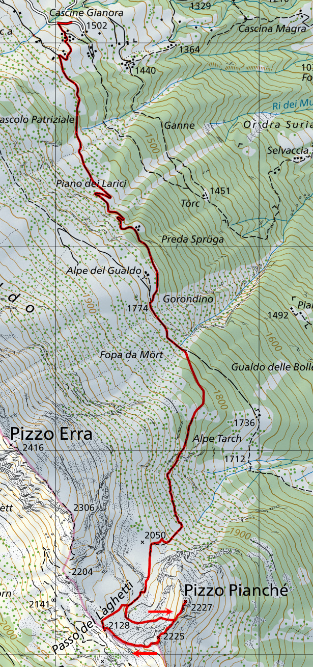
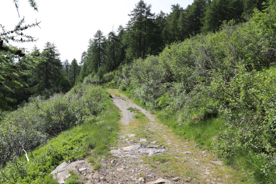
I start by reaching the locality of Cascine Gianora, shortly after Cancurì, above Leontica. I then set off along the dirt road, closed to traffic, that climbs southwards. Having reached the fork for Alpe del Gualdo, at an altitude of 1775 metres, I continue for exactly 300 metres and right at the point where the road begins to descend I find a slight track that climbs into the woods. I start to follow it and climb without any problems up to an altitude of 1820 metres. At that point the track disappears almost completely but it is not a problem; I continue climbing upwards and at an altitude of 1860 metres I reach a meadow. I cross it and on the other side the track reappears accompanied by some orange marks on the trees. I then follow it again until I reach a plateau at around 2050 metres. The section that has been covered up to here is quite visible, although in some places the grass is a little high and slightly hides the track. Now, on the other hand, the path is much cleaner, but the track can hardly be seen anymore. However, there are some red and white signs to indicate the way ahead.
I continue up to an altitude of 2100 metres, where I decide to leave the signposted route, which continues to Passo dei Laghetti, and head directly towards Pizzo Pianché. I then cross a scree slope and continue, climbing up the west side of the Pizzo, until I reach the south-west ridge that descends from the summit. I climb it and finally reach the summit.
After my lunch break, I descend along the ridge again and then climb back up the other side to reach the south-west summit of Pizzo Pianché, which is almost as high as the main summit. I then follow the west ridge where I find white and blue signs indicating the route to follow. Here, too, there are scree to cross and then I finally reach Passo dei Laghetti. All that remains for me now is to descend to the north-east and return to the route I had already followed in the morning. Following it I then return to the Alpe del Gualdo and finally to the Cascine Gianora where this excursion ends.
I would like to write one last remark. The route up to Passo dei Laghetti must once have been a path, perhaps an official one, given the presence of the track and some white-red-white signs. However, I find it a shame to let it go, given its usefulness for those who want to head into the Leventina Valley. Without it, in fact, one would have to walk 4 km southwards or 6 km northwards before finding another official path crossing the ridge.
Water (Automatic translation in english)
There is a fountain along the road at an altitude of 1593 metres and then nothing more.
Map of the Path

Summits


")


Comments (0)