
Pizzo Predèlp e Uomo del Prüch
Information
| Date: | 4 September 2022 |
| Maximum height: | 2585 m |
| Difference in height: | 1100 m |
| Length: | 9.5 km |
| Kilometers effort: | 24.1 kmef |
| Duration: | 6 hours |
Difficulties (Automatic translation in english)

|
From Predèlp to the Predèlp Pass (with some T2+ sections). |

|
From the pass to Pizzo Predèlp. |

|
From the Predèlp Pass to the Uomo del Prüch (with a few T3+ passages). |

|
From Uomo del Prüch to Alpe Sasso Jei (with some T3 passages). |
Comment (Automatic translation in english)
Since the weather forecast for the afternoon foretells variable weather, I decide to take a not-too-long hike today. I therefore choose to climb Pizzo Predèlp, a mountain on the border between the Leventina Valley and the Blenio Valley, not far from the village of Carì.
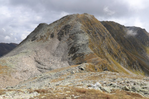
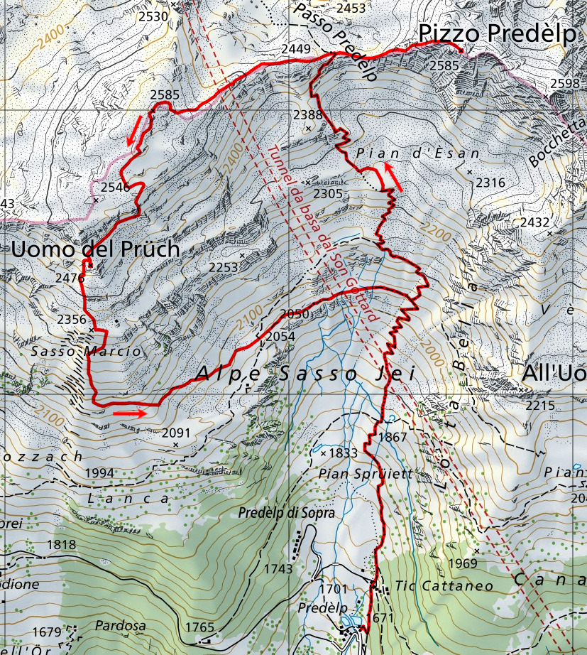
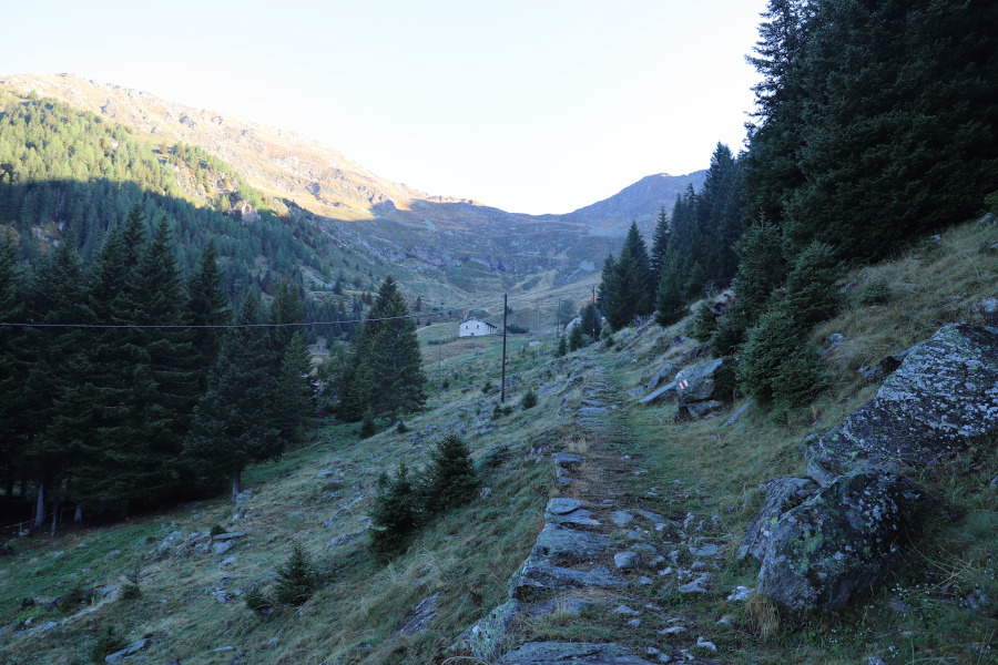
I first reach the village of Predèlp where I start walking along the path that climbs northwards. Without great difficulty I reach the pass at an altitude of 2449 metres and begin to follow the ridge that climbs to the right and leads to my destination. This last stretch is partly stony, especially in the central part, but the difficulties are never excessive. Having reached the summit of Pizzo Predèlp, I stop for a moment to have something to eat near the enormous little stone cairn about 2.5 metres high.
I then start to descend again and once back at the pass, seeing that it is still early and I don't feel like going home right away, I decide to climb the other side up to the nameless peak, 2585 metres high. This ridge is less steep than the previous one but still has some sections of scree that are never too difficult. Having reached the summit, indicated by a small stone cairn, I continue in a southerly direction to reach the Man of Prüch. Just north of this summit there is a rocky drop to climb, which on the national map looks much uglier than it really is. I decide to descend it immediately and then cross the grassy slope to the summit. Actually, as I later saw, I could have crossed it even further west and reached the summit directly from the north. To tell the truth, the Man of Prüch is only a 'summit' if you look at it from below. From above it just looks like a small hill that only rises a few metres.
At this point, as it is no longer worth going back to the Predèlp pass, I decide to descend directly to the Sasso Marcio area and continue on to Alpe Sasso Jei. I then follow the track that passes the 2050 metre mark and crosses a wide ledge that takes me back to the official path. I then descend it and return to the starting point.
Water (Automatic translation in english)
There is a fountain at Predèlp and one at Tic Cattaneo. There are also some streams along the ledge near the 2050 metre altitude point.
Map of the Path

Summits


")


Comments (3)