
Poncione di Breno
Information
| Date: | 20 May 2021 |
| Maximum height: | 1653 m |
| Difference in height: | 930 m |
| Length: | 11.5 km |
| Kilometers effort: | 23.9 kmef |
| Duration: | 5 hours |
Difficulties (Automatic translation in english)

|
From Breno to the Alpe di Mageno. |

|
From Alpe di Mageno to Poncione di Breno (with short T2+ passages on the ridge at around 1600 metres). |
|
|
From Poncione di Breno to Breno (T1 the last stretch on the road). |
Comment (Automatic translation in english)
Today's excursion has as its objective the Poncione di Breno, a mountain located just north of the better known Monte Lema.
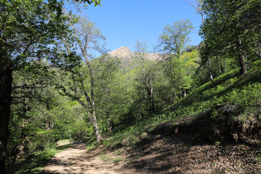
After reaching the village of Breno, I start to climb northwards along the dirt road that goes up to the Piano di Lut. This first stretch is along the didactic path called "sentiero del castagno" (chestnut path), which then continues to Arosio. I, on the other hand, after crossing the chestnut forest, continue towards the Alpe di Mageno. When I reach the alpe, the road ends and I continue along the path that, following the crest, climbs towards the peak called Zottone. At 1525 metres, the path splits into two. The one that turns left has partly disappeared. I therefore prefer to follow the right-hand path, which soon takes me to the ridge between Malcantone and Val Veddasca.
At this point, since I also wanted to climb the Zottone, I started to climb among the rhododendrons until I reached the summit. I then descended on the other side, realising that on that side there were no bushes and the climb would have been easier.
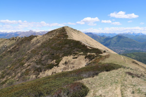
Back on the path, I continued south-west until I reached Poncione di Breno. From its summit the view is stupendous and Monte Lema, despite being a more famous mountain, remains further down.
On the way back, I decided to follow the path that passes by Forcola d'Arasio, with a short detour to Piano del Poncione, just to be able to say that I was there. From Forcola I then turned towards Alpe Tramboschino and, after a long descent, I returned to Breno and its beautiful meadows.
Water (Automatic translation in english)
There are several fountains on the ascent to Alpe di Mageno and on the return there is one more at Forcola d'Arasio. After that there is nothing more until you reach the bridge at altitude 819 metres, where there is still one more.
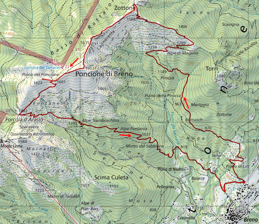
Map of the Path

Summits


Comments (0)