
Poncione Pro do Rodùc
Information
| Date: | 27 September 2023 |
| Maximum height: | 2522 m |
| Difference in height: | 900 m |
| Length: | 11.5 km |
| Kilometers effort: | 23.5 kmef |
| Duration: | 6 hours and 30 minutes |
| Lakes reached: | Laghetto di Giübin |
Difficulties (Automatic translation in english)

|
From the Ritom dam to the Passo Forca and then up to the Pizzo Forca (with a short T3 passage). |

|
From Passo Forca up to the altitude of 2380 metres, before Poncione d'Arbione (with some T3 passages). |

|
From Poncione d'Arbione to the top of Poncione Pro do Rodùc (with some grade I climbing passages). |

|
From the summit to the west foresummit at the altitude of 2507 metres and then the descent to the altitude of 2430 metres. |

|
From the altitude of 2430 metres to the altitude of 2170 metres (with some T3+ passages). |
|
|
From the altitude of 2170 metres to the path at 2051 metres. |
|
|
The final stretch to the Ritom dam. |
Comment (Automatic translation in english)
Today I return to Val Piora to climb some mountains on the ridge that borders the Leventina Valley.
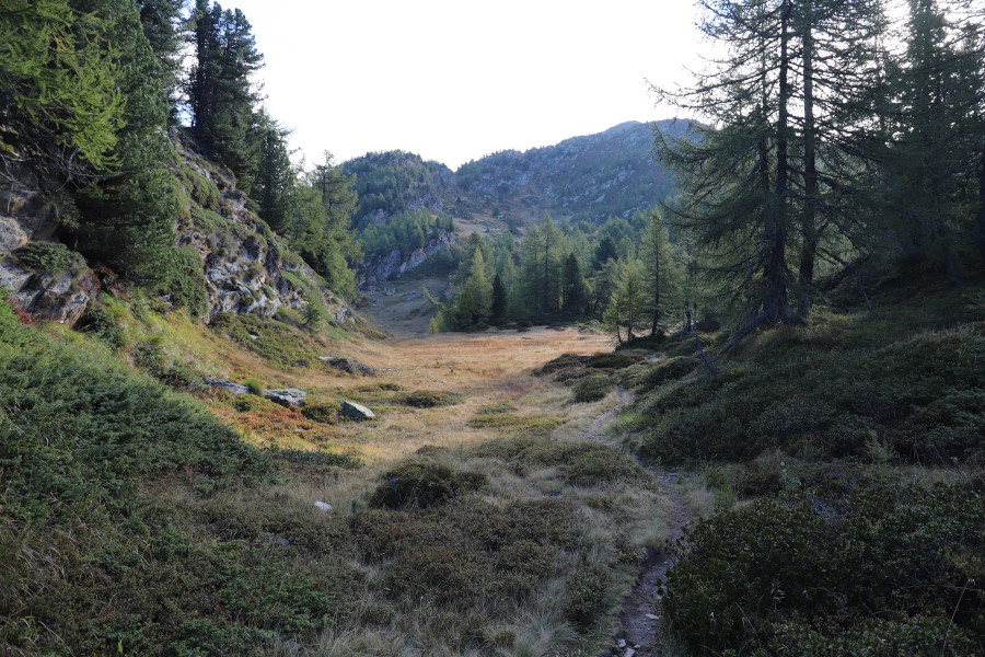
First I reach the dam of Lake Ritom where there is a pay car park (11 francs for 6 hours and 15 for the whole day). I then start walking, following the path up to the Passo Forca. Once I have reached it, I head towards the Forca following a slight track through the pastures. The summit does not protrude much from the ground but is nevertheless easily recognisable thanks to the small stone cairn on its summit.
Back at the pass, I begin to climb towards the Bassa del Cristallo. On this side, too, there is a slight track that climbs towards the east. As one continues, the ridge on the north side becomes increasingly rocky, while on the south side, where the route passes, it is full of rhododendrons, junipers and blueberries. Shortly before reaching Poncione d'Arbione, at an altitude of 2380 metres, there is a small grade I climbing passage to descend. After passing it, I soon reach the summit.
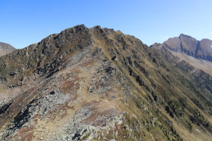
The track now continues downhill, always staying on the right side of the ridge, along perhaps the most exposed section of the entire outing. Once over it, after a short climb, I reach the summit of the Uomo d'Arbione.
I take a short break and then start to descend on the other side until I reach the unnamed nozzle at altitude 2377 metres. I then climb the easy ridge of Poncione Pro do Rodùc to an altitude of 2440 metres. At that point, I continue directly towards the summit, crossing the somewhat exposed meadows on the south side of the ridge, where there is also a slight trace (visible on the old national maps). I thus arrive at the summit, at an altitude of 2522 metres.
After my lunch break, I decide to also reach the summit at an altitude of 2507 metres. I then follow the ridge westwards where there are numerous boulders that become quite large in the last 100 metres. It is a little difficult to continue and for this reason I believe the difficulty reaches T4+. Having reached the west summit, I begin to descend towards the north-west. Perhaps it would have been easier to descend north-east, but the initial idea was to also go and see the unnamed pond north of the Man of Arbione.
Continuing the descent, up to an altitude of 2430 metres I still find several large stones, but then the terrain becomes a little easier. A little further down, however, I decide to give up on the pond so as not to lengthen the trip too much. I then head to the right where the terrain becomes flatter and the pastures begin again. I then descend along the meadows until I reach the Laghetto di Giübin, which is perhaps one of the smallest lakes in Ticino to which they have given a name. I then continue north-westwards and soon reach the path coming from the Cadagno Hut, which I follow down to Lake Ritom. Skirting the entire lake, I finally return to the dam where this excursion ends.
Water (Automatic translation in english)
Up high there is almost nothing. There are, however, a few rivers along the path along Lake Ritom.
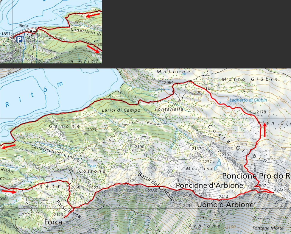
Map of the Path


")


")


")


Comments (0)