
Punta di Elgio / Helgenhorn
Information
| Date: | 13 August 2022 |
| Maximum height: | 2837 m |
| Difference in height: | 1060 m |
| Length: | 13.7 km |
| Kilometers effort: | 27.8 kmef |
| Duration: | 7 hours |
Difficulties (Automatic translation in english)

|
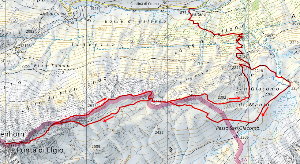
From Paltano to San Giacomo. |

|
From San Giacomo to the Punta di Elgio (the last 8 metres, T3 with grade I climbing passages). |
Comment (Automatic translation in english)
After the last long trip to Basòdino, four days ago, today I decide to do something lighter. The Punta di Elgio (Helgenhorn), a mountain not far from the Corno Gries, where I was last month, comes to mind.
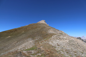
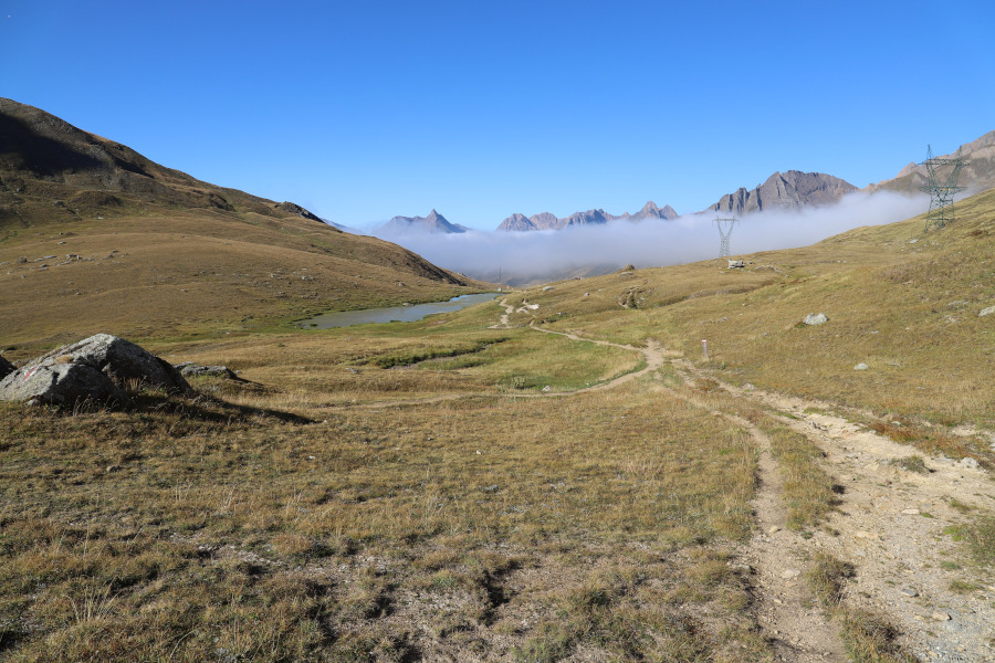
After reaching the village of Paltano, in the Bedretto Valley, along the road that goes up to the Nufenen Pass, I start walking along the path that goes up to the San Giacomo Pass. I then leave the path and start to climb up the grassy slopes in the direction of my destination. Having reached the slopes of the mountain, at an altitude of about 2640 metres, I encounter a track coming from Lake Toggia marked with red and white signs. I begin to follow it along the gully that climbs westwards to the gully at an altitude of 2740 metres. To its right is visible a rocky peak, with an overhanging wall, which at first made me think it was already the summit. Arriving at the nozzle, however, I discover that I have to climb a little further. The track continues up to the ridge and finally the Punta di Elgio appears before me. Reaching it is fairly easy, but the last 8 metres of ascent are rocky and a little more attention is required.
On the summit there is a small cairn of stones and a plaque with the name of the mountain.
After the lunch break, I start to descend again to an altitude of 2620 metres, after which I decide to continue along the ridge that forms the border between Switzerland and Italy. Having reached the summit at an altitude of 2498 metres, I descend again to San Giacomo where I take the path back to Paltano.
Water (Automatic translation in english)
There is a spring along the path up to San Giacomo at an altitude of 2185 metres.
Map of the Path

Summits


Comments (0)