
Cima di Fojorina e Denti della Vecchia
Information
| Date: | 18 May 2010 |
| Maximum height: | 1809 m |
| Difference in height: | 1320 m |
| Length: | 18 km |
| Kilometers effort: | 35.6 kmef |
| Duration: | 7 hours and 30 minutes |
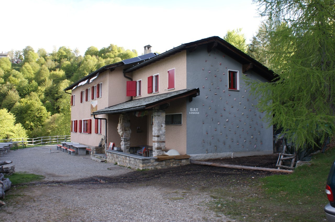
| Huts reached: | Capanna Pairolo |
| For the following peaks, there are other variants of the ascent: | Cima di Fojorina |
| Denti della Vecchia |
Difficulties (Automatic translation in english)

|
From Petrolzo to the Capanna Pairolo and then to the Cima di Fojorina. |
|
|
From Cima di Fojorina to Passo Streccione. |

|
From Passo Streccione to the channel halfway up Sasso Grande and back. |

|
From Passo Streccione down the gully to the altitude of 1260 metres (with T4 passages). |
|
|
From the altitude of 1260 metres to Petrolzo. |
Comment (Automatic translation in english)
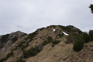
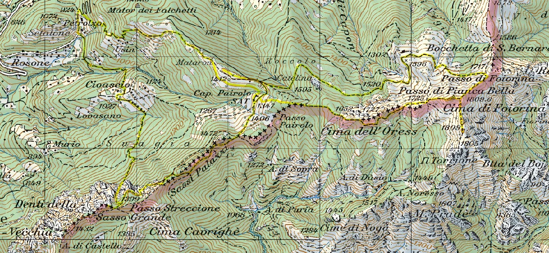
For this hike, I set off from Petrolzo, where there are few parking spaces, and began walking first towards Usin and then continued climbing towards Mataron. About 40 metres below this peak, there is a path leading directly to the Capanna Pairolo, which I followed all the way there. I then climbed Mataron, where there is a large cross and a splendid view to the east, and subsequently took the path leading to Alpe Pianca Bella (near the point marked at 1,599 metres). Once past this, after about 500 metres I reached a point where numerous paths converge and where there is a signpost. I then climbed 5–6 metres southwards until I joined the barely visible path leading to the Passo di Fojorina. From the pass, I followed the ridge towards the summit, but before reaching it, I made a detour towards the Torrione, which I photographed from a distance. Back on the ridge, I soon reached the Cima di Fojorina.
After a short break, I descend the western slope of the mountain until I reach the Pianca Bella Pass, where I continue along the path that runs alongside the ridge to the Cima dell’Oress. I then descend again to the Capanna Pairolo and from there set off towards the Passo Streccione and the Denti della Vecchia. Once at the pass, I tried to climb Sasso Grande but gave up halfway due to the strong wind. The path, however, starts from the pass and climbs straight up towards the summit. At a certain point, you reach a gully, just wide enough for one person, through which the ascent continues and where I stopped [Update: there is actually a slightly less difficult route that climbs up to the left (see the "Denti della Vecchia and Sasso Grande" hike)].
Back at Passo Streccione, I take the path heading northwards, along a gully full of rocks. After a short while, however, the route splits into two or three paths, making it difficult to tell which is the best one. There are a few slightly trickier sections (T4) before finally reaching the woods, where the path becomes a single track again and is no longer difficult [Update: the path has been improved and there are now no more T4 sections, only T3]. From here, you reach Cioascio and then finally return to Petrolzo.
Water (Automatic translation in english)
There are a few fountains now and then up to the Capanna Pairolo, then nothing. On the return journey, I found a river before Cioascio and then another one before Petrolzo.
Map of the Path

Summits
Huts
Other


Comments (0)