
Denti della Vecchia e Sasso Grande
Information
| Date: | 10 May 2022 |
| Maximum height: | 1490 m |
| Difference in height: | 950 m |
| Length: | 13.5 km |
| Kilometers effort: | 26.1 kmef |
| Duration: | 6 hours |
| For the following peak, there are other variants of the ascent: | Denti della Vecchia |
Difficulties (Automatic translation in english)

|
From Cureggia to Alpe Bolla. |

|
From Alpe Bolla to Passo Streccione. |

|
From the Streccione Pass to the altitude of approximately 1450 metres. |

|
From the altitude of 1450 metres to the summit of Sasso Grande (with some grade II climbing passages). |
Comment (Automatic translation in english)
Today I am returning to the Denti della Vecchia, this time starting from Cureggia, above Lugano.
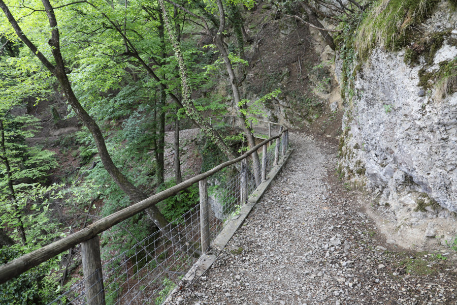
From the village I start walking along the path that goes up to Alpe Bolla, after which I continue towards Pian di Scagn and Bocchetta di Brumea. At around 1400 metres, the trail enters Italian territory and continues on to Passo Streccione.
At this point, the most difficult part of the excursion begins: the ascent to Sasso Grande. From the pass, one begins to climb by following a track through the forest. There are also yellow and blue signs indicating the direction to take. Towards an altitude of 1425 metres, go around a large rock on the north side, descending a few metres, and then start climbing again to an altitude of around 1450 metres. At that point, the most difficult section begins, where there are also some grade II climbing passages.
It begins immediately with a rocky jump, about 1 metre high, where it is necessary to hoist yourself up with your hands in order to continue. You then turn slightly to the right and continue under pine trees, which you can hold on to for more stability. Once out of the pine forest, we climb again to the left until we reach another rocky section, which can be crossed by walking over it or to the left (see photo).
You thus arrive on a plateau a few metres from the summit of Sasso Grande. By now, to reach the summit, there is only one last difficulty to overcome: a cleft in the rock about 50 cm wide and several metres deep. On the way up I skipped it at the bottom, while on the way back I preferred to go higher up (see photo).
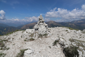
After this last passage you finally reach the summit where there is a small stone cairn and the summit book, which has been placed inside a metal box attached to the rock.
For the return I followed the same route as on the way up.
Water (Automatic translation in english)
There is a fountain just above Cureggia, at an altitude of 680 metres, and then another at Alpe Bolla.
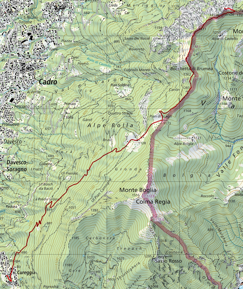
Map of the Path

Summits
Other


")

")


")


")

")


Comments (0)