
Monte Pola e Monte Magno
Information
| Date: | 17 May 2022 |
| Maximum height: | 1741 m |
| Difference in height: | 1120 m |
| Length: | 15.5 km |
| Kilometers effort: | 30.4 kmef |
| Duration: | 6 hours and 30 minutes |
Difficulties (Automatic translation in english)

|
From Vezio to Tossighera, at the altitude of 1380 metres. |

|
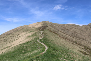
From Tossighera to Monte Pola and Monte Magno. |
|
|
From Monte Magno to the meadows above Fescoggia, at the altitude of 983 metres. |
|
|
From the meadows above Fescoggia to Vezio. |
Comment (Automatic translation in english)
Today I am heading into Malcantone to climb Monte Pola and Monte Magno, two peaks along the Monte Tamaro - Monte Lema traverse.
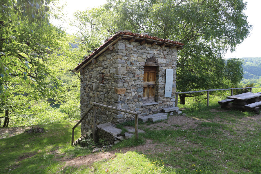
First I head to Vezio from where I start walking along the road to Mugena. Shortly before the bridge crossing the Magliasina, I turn left and start to climb towards Alpe di Coransù. Around 800 metres I reach an ancient building called Grà, which was once used to dry chestnuts thanks to the heat and smoke produced by a fire.
Having reached the alpe, I continue on to Tossighera where the road turns into a path. Continuing to climb, I arrive at Alpe Agario and immediately after at the pass where there is a small hut where it is possible to buy drinks or something to eat. Here too, as at Monte Bar, there are numerous blueberry plants that have turned red because of the drought. At this point, following the ridge that climbs northwards, I soon reach Monte Pola.
After a break, I descend back to the Agario Pass and head towards Monte Magno, my next destination. However, I decide not to climb it from the north because the slope is full of rhododendron bushes and so I continue along the path to Monte Lema. Having arrived on the east side of Monte Magno, I notice that the slope is much cleaner and so I climb it up to the summit. I then descend it from the south side, which is also fairly clean, until I return to the official path. After 200 metres, however, I leave it again to climb one last peak, Monte Magino. Back on the path, I set off towards Mottone and then begin the descent to Alpe di Mageno. I avoid passing the alp, so as not to lose altitude unnecessarily, and continue on to Monte Torri. After passing the summit, I continue my descent towards Fescoggia and arrive at an area where iron was once extracted from the ground. In fact, there are the remains of some mines that you can even enter for a few dozen metres. However, one must remember to bring a torch. The two most important ones are found along the path towards an altitude of 1224 metres and towards an altitude of 1205 metres. Continuing the descent, towards an altitude of 1090 metres, one also encounters the remains of a blast furnace that was once used to separate iron from the rest of the material, which was then discarded.
Continuing downhill I finally reach Fescoggia and following the road I return to Vezio.
Water (Automatic translation in english)
On the way up to the Agario Pass, there are several fountains. The last ones are found at Tossighera and Alpe Agario. After that, there is nothing left until the meadows above Fescoggia and then in the village centre itself.
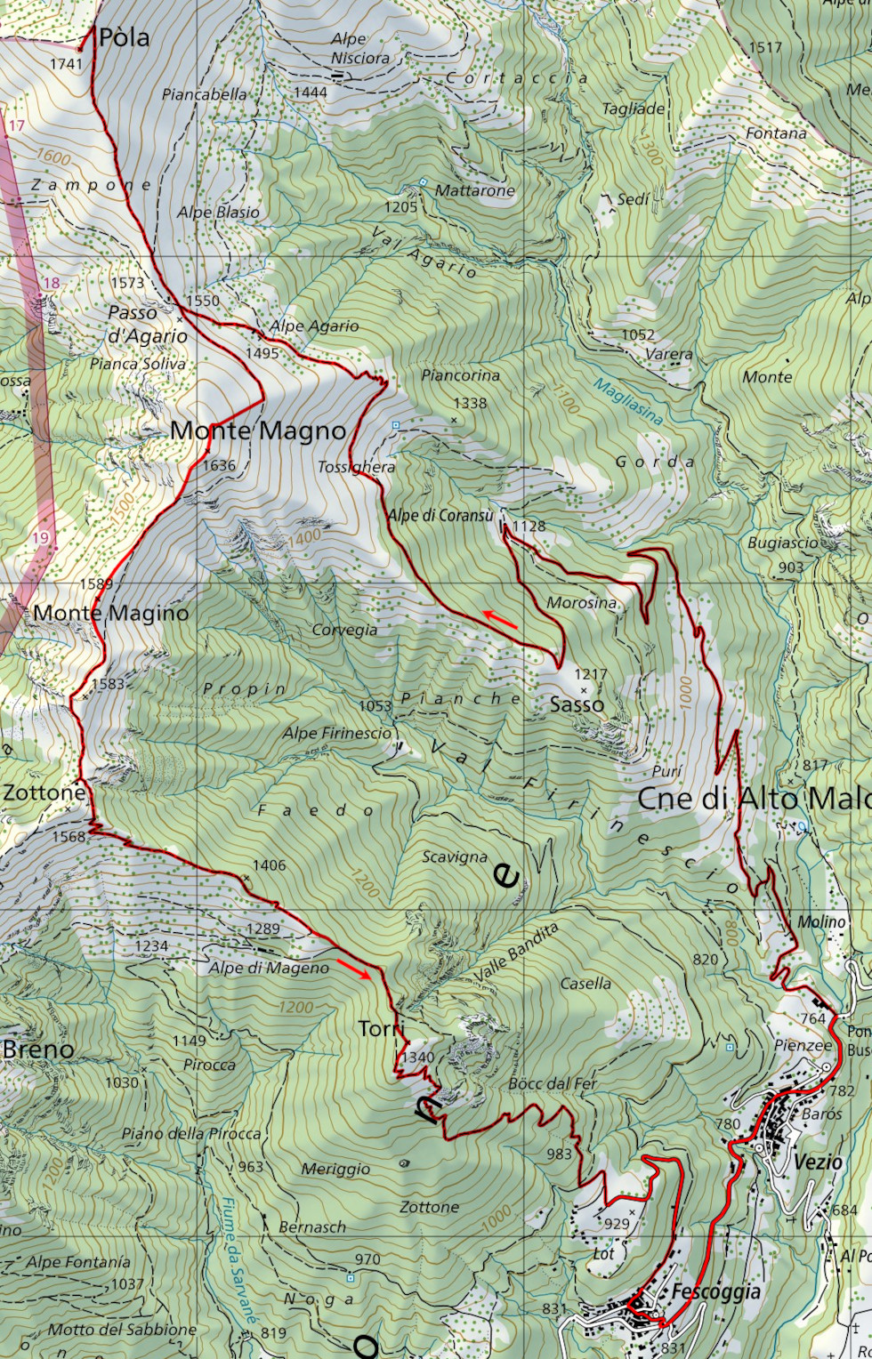
Map of the Path

Summits


Comments (0)