
Nufenenstock
Information
| Date: | 31 July 2020 |
| Maximum height: | 2865 m |
| Difference in height: | 600 m |
| Length: | 9 km |
| Kilometers effort: | 17 kmef |
| Duration: | 4 hours and 30 minutes |
Difficulties (Automatic translation in english)

|
From the curve at the altitude of 2303 metres to Mändeli. |

|
From Mändeli to an altitude of approximately 2700 metres. |

|
From the altitude of 2700 metres to the summit. |
|
|
The southern variant that passes near the Corno Pass. |
Comment (Automatic translation in english)
Today's excursion starts from the bend in the road that climbs up to the Nufenen pass on the Valais side, at an altitude of 2303 metres.
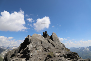
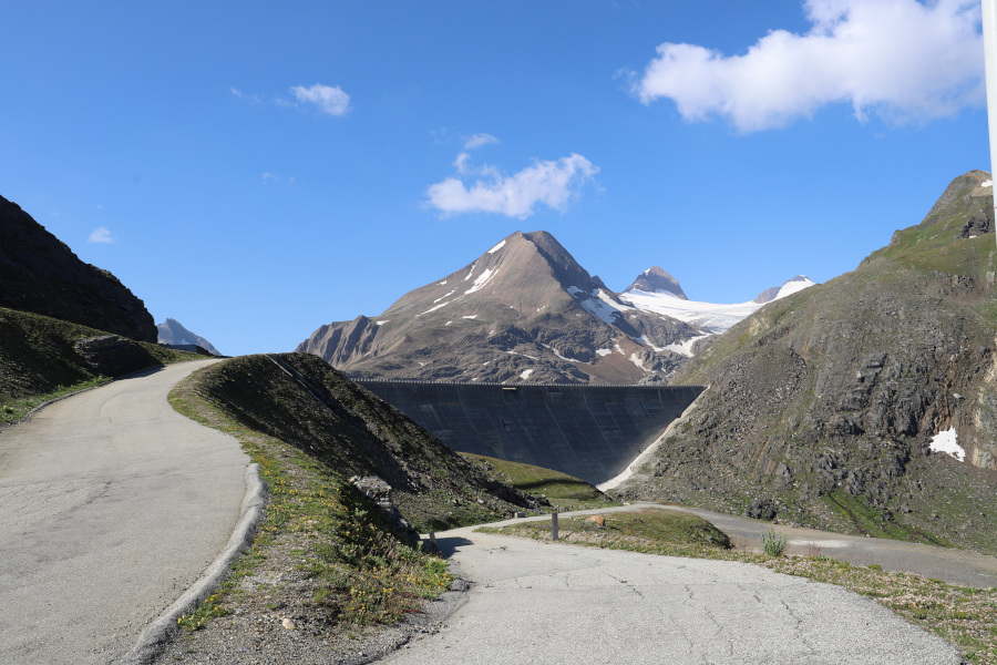
From here you start walking along the road to the Gries dam and then continue up to the Mändeli area. Then take the path that leads into Val Corno to an altitude of about 2550 metres. At this point you leave the main path and follow the little visible detour that climbs eastwards. You will then reach the south ridge of the Nufenenstock, which you will climb up to the top. Up to an altitude of about 2700 meters there are no particular problems, then the path becomes steeper and more ruined and you have to pay more attention to where you put your feet. Then, towards an altitude of about 2800 metres, the slope decreases again and in a short time you reach the summit at 2842 metres. From here you follow the ridge to the north-east, which has some technical but never too difficult passages and after circumventing a rock formation on the right you reach the summit of the Nufenenstock.
For the return trip, we follow the path we followed on the way up to the area called "Calcestro" and here we leave the path to head south-west and take a small whim; in fact, we want to reach the westernmost point of the entire Canton Ticino, which is not exactly at the Corno Pass, but a little further north. With the help of GPS we manage to get there and we are a bit disappointed because the only sign that characterizes it is a small stone man that we think is not even in the exact point but a few meters further north. We continue to descend along the easy grassy slope and take the path that comes from the Gries Pass. Once we have reached it, we follow it slightly uphill and thus return to the Mändeli area. From here we then return along the road to the starting point.
Water (Automatic translation in english)
There is no water along the entire route.
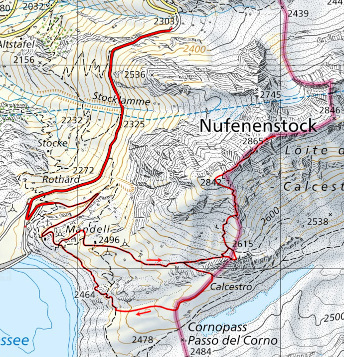
Map of the Path

Summits


")


Comments (0)