
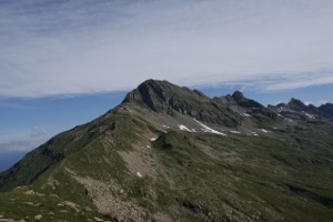
Pizzo di Claro
Information
| Date: | 6 July 2010 |
| Maximum height: | 2727 m |
| Difference in height: | 1880 m |
| Length: | 18 km |
| Kilometers effort: | 43 kmef |
| Duration: | 8 hours and 30 minutes |
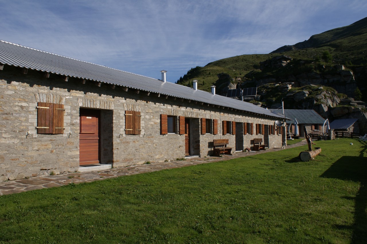
| Huts reached: | Capanna Brogoldone |
| Lakes reached: | Lago di Canee |
Difficulties (Automatic translation in english)

|
From Maruso to the Capanna Brogoldone and from there to the Passo di Mem. |

|
From the Passo di Mem to the summit and from there to Lago di Canee. |
|
|
From Lago di Canee to Maruso. |
Comment (Automatic translation in english)
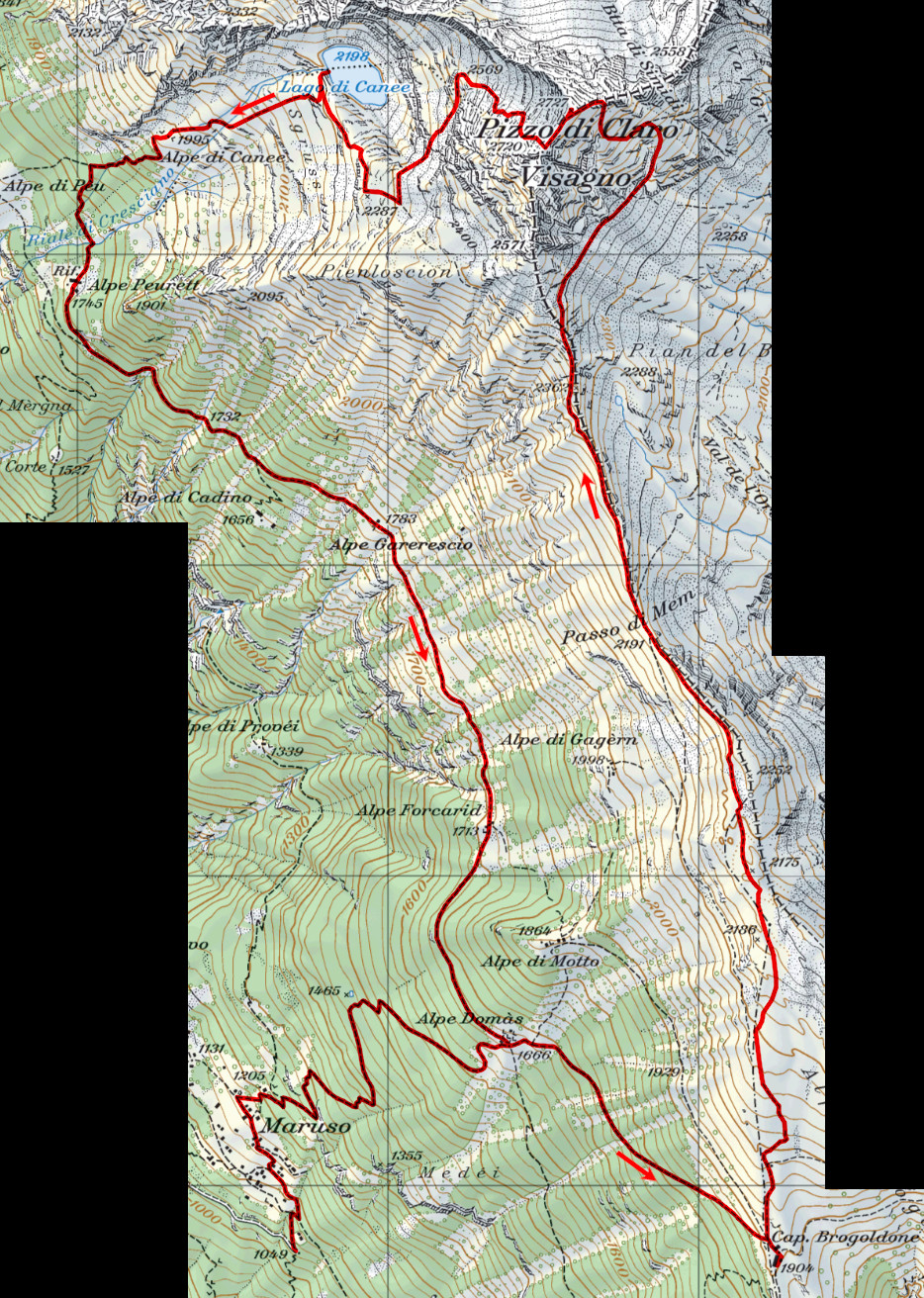
To reach Pizzo di Claro you can start from Maruso, reachable by car from Claro. Just above the village, however, there is a bar that opens only after the insertion of 5 francs (4 euros), while the return opens automatically. On the other hand, the road to Maruso is well maintained, with many rest areas to cross other cars or to park the vehicle. From Maruso go up and take the path to Alpe Domàs. At this point it is inserted on the "Path of the Sculptures" coming from the Saurù mountains (Savorù on the CN) that brings us to the Capanna Brogoldone. From here, turn left and begin to climb the grassy slopes. After a hundred meters the path begins to disappear, but is still marked by stakes. Thus you reach the Passo di Mem (on the old Gagèrn Pass maps) and from there you continue on slightly less safe paths, up to an altitude of 2380 meters. At this point you can choose the left path, which however requires a descent of at least 60 meters, or the right one, more direct. Choosing the latter continues on a stony path with little visible, up to an obvious gully. Go up and continue the climb until you cross the path that comes from Val Calanca, much more visible than ours, and you follow it to the summit. First you reach the royal peak then, continuing on the ridge, you reach the antic, 7 meters lower, where the two crosses are positioned. From here it is then possible to go down towards Lake Canee on a path that is not visible and marked from time to time. Reached the altitude of 2320 meters we meet the path that we would have taken if we had turned left at an altitude of 2380. At this point, however, we turn to the right and descend towards the lake. The path that was already not very visible becomes even less so. However, it is not a problem as the slope becomes less steep and dangerous. This finally reaches Lake Canee. From the lake we continue to the Alpe di Canee and here the path again becomes quite visible. It continues to go down into the woods until you reach a sign. At this point, cut to the left and go down to Alpe Peurett. From here continue, with different ups and downs to Alpe Domàs and then from here again to Maruso.
Water (Automatic translation in english)
There are fountains at Maruso, Alpe Domàs and Capanna Brogoldone. Then nothing more until the gully below the summit, where there is a small river that probably dries up when there is no more snow. There are also several streams on the other side of Pizzo di Claro, again probably temporary. From the lake down, in addition to the river, there is a fountain at Alpe di Canee and one at Alpe Forcarid, as well as numerous streams.
Map of the Path

Summits
Huts
Lakes


Comments (0)