
Pizzo di Vogorno
Information
| Date: | 9 September 2022 |
| Maximum height: | 2442 m |
| Difference in height: | 1920 m |
| Length: | 17.8 km |
| Kilometers effort: | 43.4 kmef |
| Duration: | 10 hours and 30 minutes |
| Huts reached: | Capanna Bardughè |
Difficulties (Automatic translation in english)

|
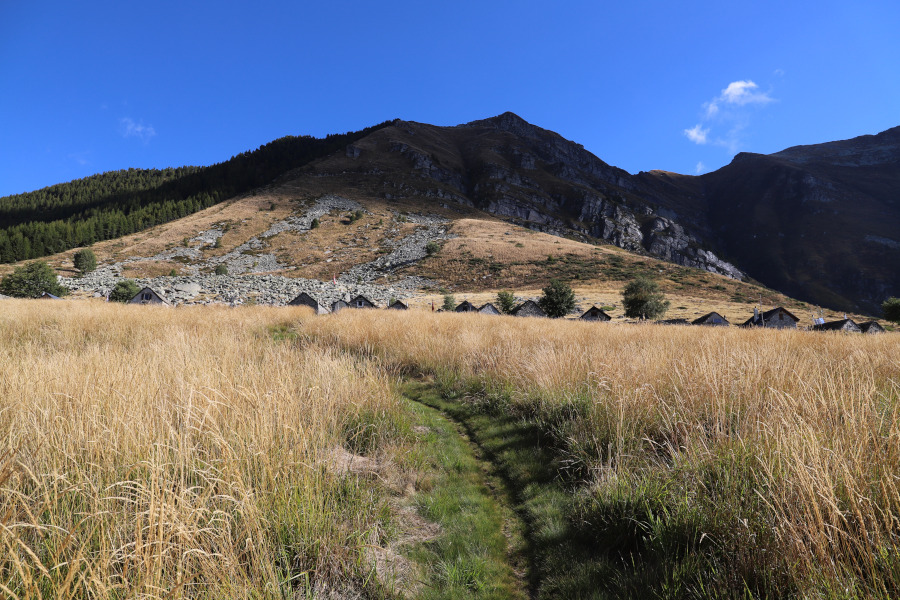
From Costa Piana to Alpe Bardüghè. |

|
From the alp to the pass at an altitude of 2271 metres. |

|
From the pass to the summit of Pizzo di Vogorno (with some short grade II climbing passages). |
|
|
From the peak up to Alpe Lòcia (with a few grade II passages, secured with handholds and chains, around 2280 metres). |
|
|
From Alpe Lòcia to Costa Piana. |
Comment (Automatic translation in english)
Pizzo di Vogorno is a mountain in the Verzasca Valley characterised by a beautiful pyramid shape. To reach it, you can start from the village of Vogorno or you can try driving up to Costa Piana, where, however, parking spaces are scarce and often already occupied. Today I am lucky and manage to find a free one.
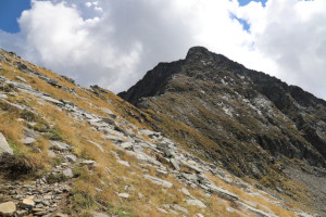
I then start walking towards Alpe Bardüghè along a very beautiful path that climbs with a constant gradient. At the alp I stop for a moment at the hut, after which I set off again in the direction of Pizzo di Vogorno. As I climb, the path becomes more challenging and the rocks begin to increase. Having reached the north ridge of the mountain, I begin to climb it, encountering, at around 2310 metres, a short rocky drop to overcome (grade II climbing). Continuing on, I then reach a ledge that crosses the entire western slope of the peak until I reach the southern slope. At that point, after a short ascent, I reach the summit where I find a granite plaque with the name of the mountain and a piece of the barrel of a cannon brought by the military.
After my lunch break, I start to descend again, this time on the other side of the mountain. The route follows the south ridge until reaching, at an altitude of 2300 metres, a somewhat steep gully that has been equipped with chains and iron handles. We then continue along the path that descends to Crápia and then continues to Alpe Lòcia. At an altitude of 1830 metres there is a river to cross, which when it is in flood can cause some problems (see photo). Having arrived at the alp, it would have been possible to descend directly to Rienza, but not knowing the path, which is not official, I preferred to follow the one that passes by Alpe Stavascio, which is. I then descended all the way down the Val della Porta to the Oratorio della Colletta after which, with a final climb, I returned to Costa Piana.
Water (Automatic translation in english)
There are a few fountains along the path up to Alpe Bardüghè as well as at the alp itself. On the way back, however, I found one at Crápia, one at Alpe Lòcia, one at Rienza and finally one near the Oratorio della Colletta. There are also some streams above Alpe Bardüghè at altitudes of 1830 metres and 2000 metres.
Map of the Path
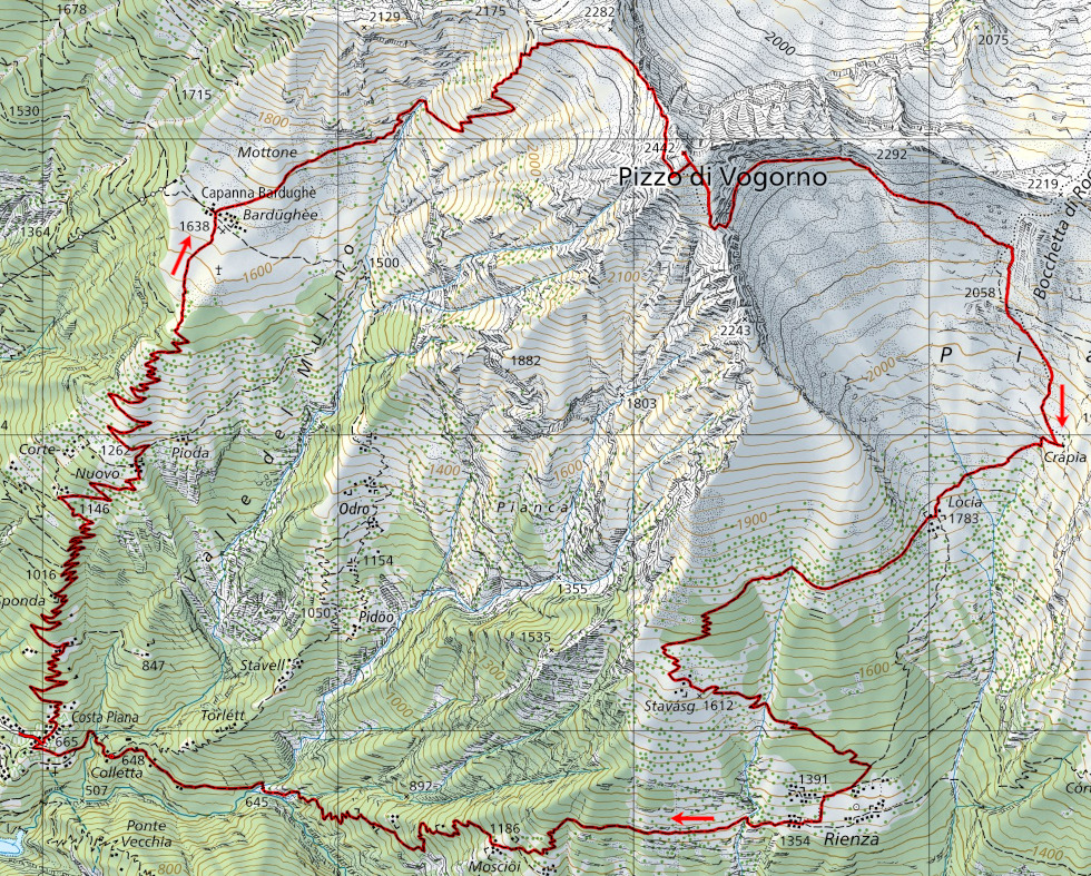

Summits
Huts


")


Comments (2)
Haben diese Tour genau wie beschrieben schon mehrmals unternommen und muss sagen ein absolutes Highlight
Tolles Erlebnis!!!