
Rosso di Ribia (cima sud-ovest)
Information
| Date: | 27 July 2023 |
| Maximum height: | 2546 m |
| Difference in height: | 1580 m |
| Length: | 12 km |
| Kilometers effort: | 33 kmef |
| Duration: | 9 hours and 15 minutes |
| Huts reached: | Capanna Ribia |
Difficulties (Automatic translation in english)

|
From the valley floor before Piéi to the Capanna Ribia (with some T2+ passages). |

|
From the Capanna Ribia to the beginning of the couloir at the altitude of 2490 metres (in the first part many sections T2+). |

|
From the beginning of the couloir to the top of Rosso di Ribia (with some grade II climbing passages). |
|
|
The section to the small lakes in the Piròi area and then the descent to the path at the altitude of 2208 metres. |
|
|
The return to the Capanna Ribia. |
Comment (Automatic translation in english)
The Rosso di Ribia is a mountain on the border between the Valle di Campo and the Valle di Vergeletto. It consists of two peaks, one to the north-east and one to the south-west. The latter is the higher and less difficult of the two and is also the one I will climb.
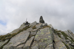
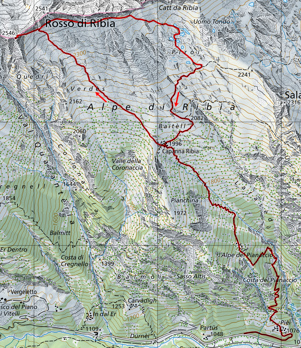
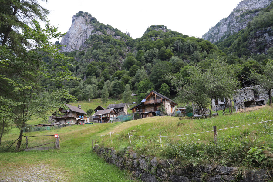
I decide to start from the Vergeletto Valley so that I can also see the Capanna Ribia. I therefore start walking from the bottom of the valley where it is possible to leave the car along the road. I then walk up to Piéi where there are several houses. I then follow the path up to Alpe del Pianaccio and continue until I reach Alpe di Ribia where there is a hut of the same name. At this point I take the new Via Alta Vallemaggia trail, built a few years ago, which climbs towards Rosso di Ribia and then descends to Lago del Pèzz. The trail is light but there are many white and blue signs marking the way. The first section crosses meadows but then, towards an altitude of 2400 metres, there are some easy scree to cross. In this way I reach the gully between the two peaks of Rosso di Ribia. Here the ascent becomes a little more challenging and steep, but there are numerous chains and iron handles that help the climb. In a couple of places, however, one has to pull oneself up with the strength of one's arms and thus reaches grade II climbing. I arrive in this way at the vent at an altitude of 2520 metres, which overlooks the Valle di Campo. The white and blue route continues downhill towards Lago del Pèzz, while on the left are the last rocky slabs before the summit. Here too there are a few short grade II passages to climb, after which I finally reach the south-west summit of Rosso di Ribia.
After having something to eat, I start to descend again, also because the sky is getting cloudy. I follow the outward route again as far as the vent and then descend the gully again. Having reached an altitude of 2440 metres, however, I decide to abandon the path to go and see the small lakes in the Piròi area. I then begin to skirt the east ridge of Rosso di Ribia, walking along the strip of grass between the rock face and the scree below. On the internet, in fact, I had already seen someone following this route. A slight trace was also visible on satellite images. In fact, however, the track was hardly visible at all and only after about 600 metres did I manage to find it. I follow it for a short distance but then have to abandon it because by now the small lakes are below me. I then descend across the meadows until I reach them and then continue south until I return to the official path that descends to Alpe Ribia. Following the latter, I return to the hut and after a short break I descend back to the valley floor where I conclude this excursion.
Water (Automatic translation in english)
There is a fountain at the Capanna Ribia and further down there is possibly the river that you cross at an altitude of 1793 metres.
Map of the Path

Summits
Huts


")


Comments (0)