
Il Madone
Information
| Date: | 27 July 2020 |
| Maximum height: | 2756 m |
| Difference in height: | 500 m |
| Length: | 5 km |
| Kilometers effort: | 11.6 kmef |
| Duration: | 4 hours |
| Lakes reached: | Lago di Val Sabbia |
| Lago del Madone |
Difficulties (Automatic translation in english)

|
From Lake Narèt to Lake Madone (at the altitude of 2525 metres). |

|
From Lago del Madone to the summit and back (with some T4 passages north of Passo del Madone). |

|
From Lake Val Sabbia to the Narèt dam via Lake Fornà (some T4 passages present 80 metres north-east of the dam). |
Comment (Automatic translation in english)
Today's excursion takes place in one of the most remote areas of Canton Ticino, the Narèt region.
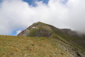
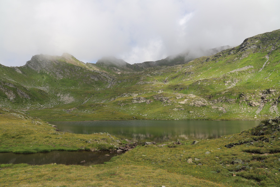
Once you reach Lake Narèt, at the bottom of the northern dam there is the starting point of the path that leads up to Val Sabbia. We follow it and in a short time we reach the Val Sabbia Lake. From there we start to climb northwards along easy grassy slopes where there is an old trail. We thus arrive at the unnamed small lake at an altitude of 2525 metres, which some call Lago del Madone. From here the path becomes more challenging. Since there is a stretch of rocky ridge just north of the Madone Pass, we try to go around it by climbing a little to the right. The grassy slope is however quite steep and for a short stretch also a little exposed. Once we reach the south ridge of the Madone, the most difficult piece has passed and in a short time, following the ridge, we reach the summit.
On the way back we descend the ridge uphill again, but this time we leave it higher up, towards an altitude of 2640 metres. Going up we realized that the slope in that place is less steep and less exposed than the one followed uphill. So I suggest to follow this more northerly route, rather than the other, even going uphill (see map).
Once back at Lago del Madone, we descend by the same route to Lago di Val Sabbia. Here we decide to go to see the nearby Fornà Lake and then instead of going straight down to the Narèt Dam, we head east-north-east. After having climbed about seventy metres we descend again towards the lake until the fork at an altitude of about 2365 metres. Then we take the path that turns south and in a short time we return to the starting point.
Water (Automatic translation in english)
Along the Val Sabbia there are a few streams flowing from small lakes and then nothing.
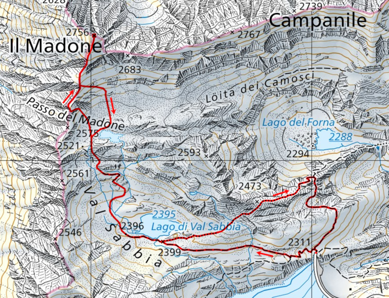
Map of the Path

Summits
Lakes


Comments (0)