
Piz Giümela (Piz Red)
Information
| Date: | 11 June 2022 |
| Maximum height: | 2444 m |
| Difference in height: | 1280 m |
| Length: | 13 km |
| Kilometers effort: | 30 kmef |
| Duration: | 8 hours |
| Huts reached: | Rifugio Alpe di Giümela |
Difficulties (Automatic translation in english)

|
From Biborgh to the Alpe di Giümela hut. |

|
From the Refuge to the Giümela Pass. |

|
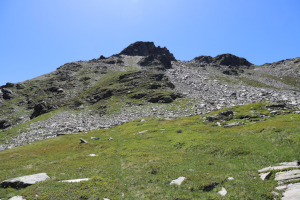
From the pass up to the altitude of about 2370 metres (with some T3+ passages). |

|
From the altitude of 2370 metres to the summit of Piz Giümela (with some T4 passages). |
|
|
The descent from the summit to the altitude of about 2200 metres. |
|
|
From the altitude of 2200 metres to the Alpe di Giümela hut. |
Comment (Automatic translation in english)
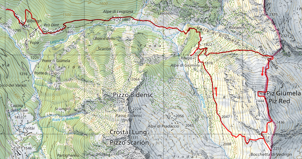
Today's hike takes place in Val Pontirone and is aimed at Piz Giümela also called Piz Red.
Having climbed up the valley, we leave the car just before Biborgh, where there are a few patches of grass on the edge of the road. We then start walking to the village, where we would normally have taken the path from the crossroads at an altitude of 1295 metres. This path, however, has been closed for some years due to landslides. The diversions to follow instead climbs first towards Mazzorign and then, at an altitude of 1380 metres, turns towards Prò Dint. This section is not yet marked on the national map.
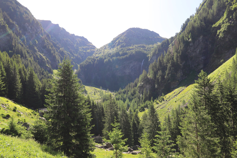
Returning to the official path, we ascend it to Alpe Legiüna, after which we come to a meadow from which we can admire a beautiful waterfall. At that point the path becomes steeper and leads us up to Alpe di Giümela, where we find a nice hut waiting for us. However, we cannot stay too long because the ascent is still long. We therefore start walking again until we reach the Giümela Pass, where we leave the path to start climbing towards our destination. Towards an altitude of 2370 metres we reach a rock face that can be circumvented from the west or from the east. On the latter side, however, there are nets that serve as avalanche shelters and we are not sure whether they can be easily overcome. This is why we prefer to circumvent the mountain from the west. We then cross a scree slope to return to the meadow and finally reach the summit of Piz Giümela.
For the return trip, so as not to return from the same side, we decided to descend on the other side of the mountain. We then followed the ridge southwards until we came to a strange construction that probably serves to house workers. We then descended until we reached a rocky drop, which we passed thanks to an easy gully. At that point, seeing that the Bocchetta di Vedrign was very close, we went for a moment to see it. We then turned back and started to descend towards the bottom of the valley until we reached the path coming from Alpe di Pradaccio. We then followed it until we returned to the Alpe di Giümela hut where we could finally fill our water bottles. We finally descended to Biborgh by the same route taken on the outward journey.
Water (Automatic translation in english)
There is a fountain along the road, 300 metres before Biborgh and then one more at the Alpe di Giümela hut. There are few streams and not much water.
Map of the Path

Summits
Huts


Comments (0)